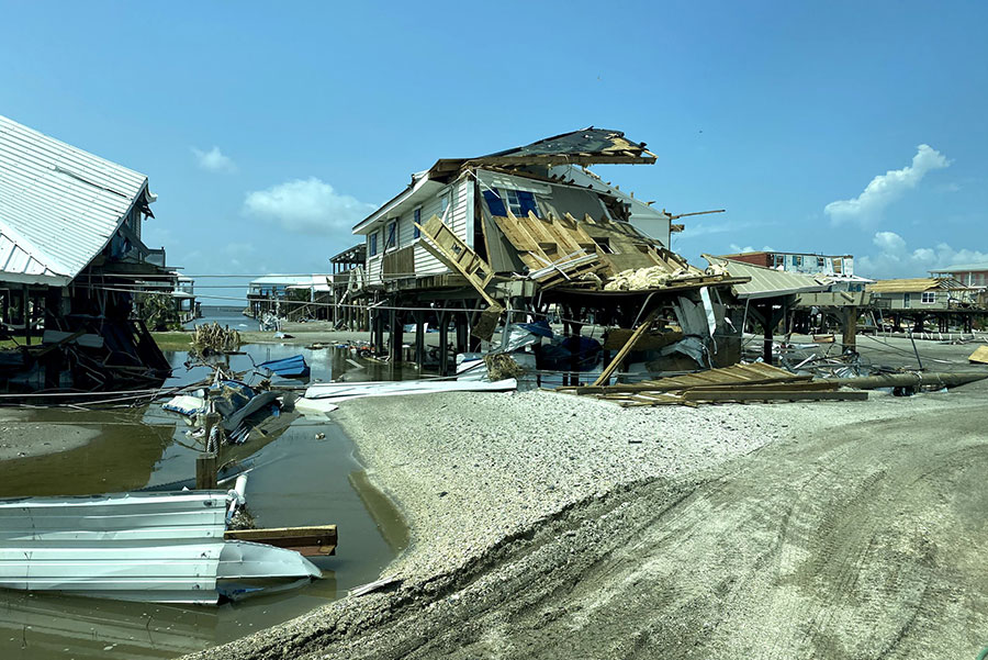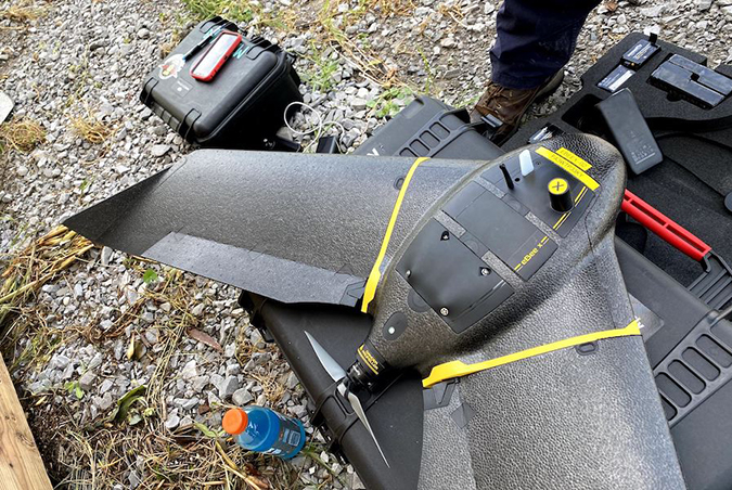
The Florida State University Center for Disaster Risk Policy’s drone team was taken by a Blackhawk helicopter into Grande Isle, Louisiana, last month to lend its expertise in the wake of Hurricane Ida.
That’s the first time a drone team has been airlifted into a disaster impact area as part of an urban search and recovery effort, said CDRP Director David Merrick. It also underscores the increasingly vital role the center is playing in rescue and recovery efforts as they provide accurate, near-real-time data in lieu of maps that are typically weeks and months old.
Merrick said the timely, accurate information that drones provide saves time — and lives.
“One of the big challenges after any major event is about where to send resources first,” he said. “Those decisions are made from operations centers that are 10, 20, 100 miles away. So answering those questions in a faster, convenient way helps minimize mistakes and ensures the right communities get the right supplies and the right help faster.”
CDRP has previously brought their expertise to bear on responses to natural disasters, including Hurricane Harvey in Texas in August 2017 and Hurricane Michael in the Florida Panhandle in October 2018. Most recently, the team provided its services in the wake of the Champlain Towers collapse in Surfside, Florida, last June.

For Ida, Merrick and his team spent six days in Louisiana, sleeping on the conference room floor of the State Fire Marshal’s office while making daily hours-long commutes to deploy their hardware and expertise to areas hit by Ida.
“In Grand Isle we flew video reconnaissance that was geotagged so you could look at the map and give people a clearer look at what they are seeing,” Merrick said of the CDRP’s work after Ida. “The first day we took 1,200 still images. We use software that stitches that together into a single map. All those tools go to help the people in charge of the recovery effort make good decisions about what’s going to happen next.”
Fortunately, on Grand Isle most inhabitants had evacuated, Merrick said.
“We just found pretty significant damage, and they clearly took the brunt of the storm,” he said. “There was still flooding, still areas underwater. A lot of homes were completely destroyed, swept off their foundations.”
FSU began offering a drone certification program in 2014, one of the first programs of its kind in the country. Other firsts have followed, Merrick said, noting that FSU is now a leader in the use of drone technology in disaster reconnaissance.
The technology continues to evolve, meaning longer flight times for drones thanks to extended battery life with more advanced software and hardware providing more accurate information.
“We are putting the resources into determining the best practices of how to do this efficiently, how to integrate it locally and federally and what that should look like,” he said. “We are one of the only ones doing that work.”


