

When the Deepwater Horizon oil rig suffered a blowout in 2010 and began spilling oil into the Gulf of Mexico, scientists got to work understanding the effects of that disaster.
But limited data on the typical conditions in the Gulf made understanding the potential changes from the spill more difficult. To make sure scientists weren’t caught unaware in the future, Florida State University and partner universities investigated current baseline conditions in the southern Gulf to create a series of maps and guides that detail the distribution of carbon, nitrogen and the carbon-14 isotope.
These elements are all important ecological factors that contribute to the natural habitat supporting untold number of plants, fish and other marine life.
The study was published in the journal PLOS ONE.
“The Gulf of Mexico is a productive system that is important both in ecology — by providing unique habitats for various species— and economy, for industries such as tourism, fishing and the oil industry,” said Samantha Bosman, a research assistant in the Department of Earth, Ocean and Atmospheric Science and the paper’s lead author. “The ecosystem may not go back to its pre-spill or pre-disturbance conditions, so having a baseline makes it easier to determine how much has changed after the disturbance. That helps you determine if conditions are returning to what was observed prior to a spill or if they are changing to a ‘new normal.’”
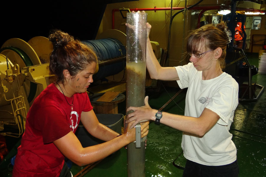
Florida State researchers worked with colleagues from the University of South Florida, Eckerd College and the National Autonomous University of Mexico to complete fieldwork for the project in 2015 and 2016.
“This joint collaboration of Mexican and U.S. scientists brought together people with unique skill sets and significant local knowledge,” said Jeff Chanton, a Robert O. Lawton professor of oceanography in the Department of Earth, Ocean and Atmospheric Science and a co-author of the paper. “They were able to access the environmental health of the southern Gulf, which is subject to significant oil and gas recovery.”
The researchers surveyed the southern Gulf of Mexico, an area that had been home to the Ixtoc 1 well, which suffered a blowout and massive oil spill in 1979. Along with measuring the typical distribution of elements, the study looked for evidence of oil within the sediment that could have come from that spill, but they didn’t find any signs of that disturbance remaining.
The oil industry and fishing industry exist side-by-side in the Gulf of Mexico. Millions of people live around its coast. An understanding of the baseline conditions in the ecosystem will help scientists looking at the impacts and recovery of the environment in the event of any future oil spills.
One particular area of interest to scientists was the composition of sediment on the seafloor. To understand typical conditions in the region, the researchers measured how much carbon, nitrogen and carbon-14 were in the sediment.
Before this research, there was limited data on the sediment composition in the southern Gulf. Understanding the composition provides scientists greater insight into when fossil fuels might have entered the environment.
For example, scientists can measure the carbon-14 found in organic material. Younger material has higher levels of the isotope, and older materials have lower levels. Right after an oil spill, scientists should find very low levels of carbon-14. As the oil degrades and the ecosystem recovers, the level will increase.
“In the event of an oil spill, that’s a big slug of carbon emitted to the surface of the Earth,” Chanton said. “And everything in the surface of the Earth has carbon-14 in it because it’s pretty modern. Sediments have a modern date. When you add petroleum or some petroleum product to the sediments, they look older, and that’s because they’re being diluted with fossil fuel.”
But that analysis is most useful when scientists know what the typical measurement is for a particular location, allowing them to understand when conditions have returned to normal.
As their sampling sites moved from near the coastline to further out to sea, the researchers found that the amount of carbon increased but the amount of carbon-14 decreased. This information showed them the sediment they were pulling up was older.
“The better you know the pre-existing conditions, the better off you are when something happens,” Chanton said.
This work was supported by the Gulf of Mexico Research Initiative.