When powerful hurricanes emerge from the churn of ocean and atmospheric flux to menace coastal communities, officials will often urge vulnerable populations to gather their valuables and take flight.
But for some daring scientists, the idea of “taking flight” in the face of a looming hurricane means something entirely different.
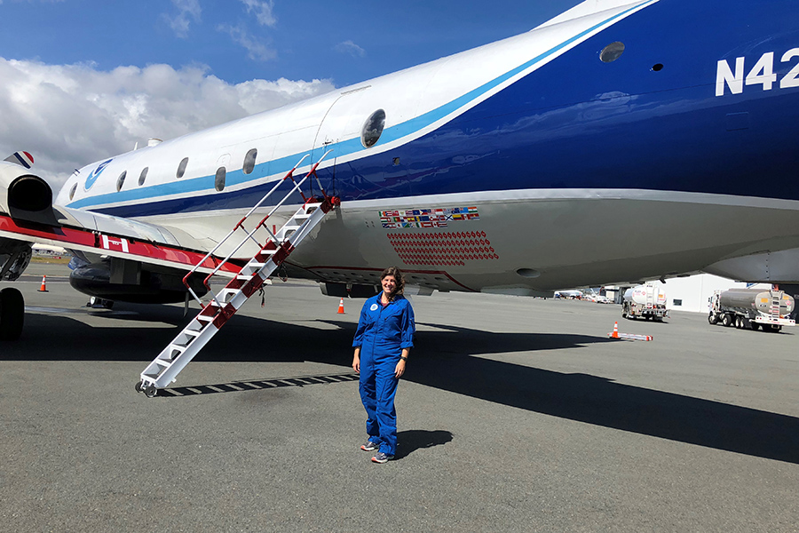
Heather Holbach, a postdoctoral researcher in FSU’s Center for Ocean and Atmospheric Prediction Studies, is one such scientist. When a hurricane thrashes its way through the warm waters of the Atlantic or Caribbean, she and her colleagues at the National Oceanic and Atmospheric Administration collect their sophisticated storm monitoring tools, board a Lockheed WP-3D research plane and knife their way through the storm and into the eye, making high-resolution observations along the way that provide critical information to storm forecasters.
Holbach has been hurricane hunting for five years, including a recent flight through the devastating Hurricane Florence. She spoke to news.fsu.edu about her experiences studying these mighty storms up close.

Why fly into a hurricane? What kind of scientific readings are accessible inside a storm that aren’t accessible remotely?
While satellites can provide us with a broad view of the environment and some of the basic characteristics of tropical cyclones, they are not able to provide the high-resolution, detailed observations that forecasters and models need to obtain the most accurate forecasts. In order to obtain these observations, we need to fly into hurricanes with specially equipped hurricane hunting aircraft.
These aircraft have instruments on them to measure winds, temperature, pressure and many other variables in high-resolution. They are also able to deploy special sensors called dropwindsondes that obtain profiles of wind, temperature, pressure and humidity as they fall through the atmosphere to the ocean surface. All of this data is sent to the National Hurricane Center and modeling centers in real-time where they are then able to get the most accurate representation of the tropical cyclone and generate more accurate forecasts.
How do you prepare to fly into a hurricane?
Two hours before each mission into a tropical cyclone, we have a preflight briefing where the flight meteorologist presents the current weather, potential hazards and goals of the mission to the flight crew. The lead project scientist also answers any questions from the flight crew during the briefing to ensure that they fully understand the scientific goals of the mission.
One of the main differences for me in my preparation for these flights compared to a commercial flight is that about an hour before the flight I, along with many of the other scientists, will take motion sickness medication. These flights can get quite turbulent at times, so we want to ensure that we can accomplish our duties throughout the entire flight without getting sick. We then have another briefing from the aircraft commander on the plane about 45 minutes before takeoff to review the plan one last time, answer any last questions and review the aircraft safety procedures.

Describe what it feels like being thousands of feet above the Earth in the middle of a hurricane.
The NOAA WP-3D is a four-engine turboprop plane. We typically fly at about 8,000 to 10,000 feet above the ocean surface in a hurricane. At these altitudes you can still see individual waves breaking on the ocean surface when you are not flying through clouds, but I have never felt unsafe flying at that altitude in a hurricane.
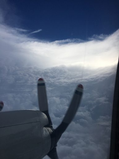
Most of the flight is pretty smooth, especially when you are inside the eye of a hurricane, and is actually quite similar to a commercial flight just much closer to the Earth’s surface. However, the eyewall and some of the outer rain bands can be fairly turbulent at times. The pilots and flight crew are extremely well trained, so they know exactly how to react to any sudden changes in altitude associated with turbulence. Overall, it is an amazing experience to get out into the storms and see firsthand what it is that we are studying, so that we can better relate what we see in the data to what is going on in reality.
Describe your first experience flying into a storm. Has the experience gotten easier with repetition?
My first flight was into Tropical Storm Ingrid in 2013. I was very excited since this was a goal that I had when I first decided to become a meteorologist. Since my research focuses on the remote sensing of surface winds at the ocean surface, one of the most striking memories I have from this flight was my fascination with how quickly the ocean waves changed as we flew through the storm. This was an experience that really helped me improve my understanding of the science behind what I was studying by connecting it to something I could see. Since that first flight, my fascination with observing the waves on the ocean surface has never gone away, and I still love getting out there because I learn something new every time I do.
What’s the hardest part of flying into a hurricane?
The hardest part of flying into a hurricane is the exhaustion that can come along with flying for seven to nine hours at a time and then repeating that for multiple days in a row. Along with that, we sometimes fly at odd hours of the day, which can be rough on your body since your internal clock is not always in sync with the flight schedule. Trying to sleep during the day can be quite challenging. However, dealing with any exhaustion that may come with the job is greatly outweighed by the experience and knowing that the data we are collecting is helping to improve the forecast so that anybody that may be in harm’s way can be better prepared.
What is one thing people may find surprising about your work?
One thing that people may find surprising about flying into hurricanes is that sometimes the strongest hurricanes can be the smoothest flights. We never know until we get out there how bumpy of a ride it is going to be. I have been in some tropical storms and weak hurricanes that were more turbulent than my flight into category 4 Hurricane Florence.


