The Southeast Climate Consortium is predicting a warm and dry winter and spring until May 2009 for Florida with the return of La Niña in the Pacific Ocean.
It is unusual for La Nina to raise its signal so late in the winter, according to David Zierden, climate scientist at Florida State University’s Center For Ocean Atmospheric Prediction Studies (COAPS) and state climatologist of Florida.
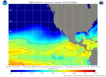
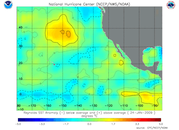
La Niña refers to a state of the tropical Pacific Ocean where surface temperatures along the equator from South America to the central Pacific turn colder than normal. La Niña can be thought of as the opposite of El Niño, where the same area of the Pacific is much warmer than normal.
La Niña affected Florida’s climate patterns last winter as well before dissipating in April 2008. From that time until mid-December, surface temperatures in the Pacific Ocean had been near normal, or the neutral phase. Driven by stronger than normal trade winds in the central Pacific since October, colder water has recently broken through to the surface over a large area and has taken on La Niña characteristics. This La Niña is expected to last through the remainder of the winter and into spring, Zierden said.
La Niña is known to bring winter weather patterns to the state of Florida that are usually warmer and drier than normal. Historically, the peninsula of Florida averages rainfall 40 to 60 percent below normal in the months of January through March during La Niña events. Temperatures over the entire state average 3 to 4 degrees warmer than normal.

“The expected dry pattern could hasten the return of drought to the state,” Zierden said. “West central Florida is already in moderate drought, according to the U.S. Drought Monitor, while the rest of the peninsula is considered abnormally dry.”
Spring and early summer is a critical time for drought impacts across the state, as rising temperatures and the extended winter dry season combine to stress vegetation and water resources. Water stored in Lake Okeechobee from plentiful summer rains and tropical storm Faye will help buffer South Florida against the impacts of La Niña.
La Niña also brings the potential for a very active wildfire season. Acreage burned is often more than doubled over the average in La Niña years, as was seen in 1998 and 2001.
Warmer temperatures may slow the chill accumulation in flowering fruits such as blueberries, peaches and strawberries, but enhance development of other crops. While mild freezes can be expected every year in north and central Florida, La Niña reduces the risk of severe freezes in the citrus and vegetable belts.

The Southeast Climate Consortium is a partnership of seven universities in Florida and the Southeast aimed at bringing seasonal climate prediction to better use in the management of agriculture and natural resources in the Southeast. The partners are FSU, University of Florida, University of Miami, The University of Georgia, Auburn University, University of Alabama-Huntsville and North Carolina State University.
For more detailed information on La Niña and climate forecasts, visit www.agroclimate.org and www.coaps.fsu.edu/climate_center.


